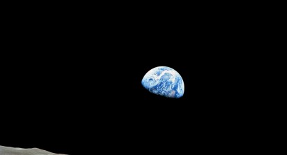
What exactly is historical satellite imagery? Simply put, it’s a collection of photographs of Earth’s surface taken from satellites over an extended period, often spanning decades. These pictures, captured from space, provide a view of our planet’s landscapes, oceans, and atmosphere on a scale no other method of monitoring can offer.
Imagine flipping through a huge photo album of our planet, where each page reveals a different moment in time. This album, crafted from satellite images, captures the dynamic changes in our environment. From tracking the shrinking of glaciers to observing the growth of urban areas, historical satellite imagery data offers a visual record of our world’s evolution.
In studying environmental changes, this imagery is simply priceless. It allows scientists and researchers to rewind time and observe how natural and human activities have altered landscapes all over the globe. By analyzing patterns and trends, they can make informed predictions about future environmental shifts and devise strategies for sustainability. Essentially, historical satellite images are our window into the past, helping us understand and protect the future of our planet.
But before we discuss why this type of satellite image is so important, let’s quickly go through the milestones of satellite imaging technology.
Evolution of Satellite Imaging Technology
The journey of satellite imaging technology is a captivating tale of progress. It began in 1960 with NASA’s TIROS missions, which captured the first satellite image of Earth, laying the foundation for modern weather forecasting.
The launch of Landsat 1 in 1972 marked a significant leap, being the first satellite designed for global land observation with a multispectral scanner. This innovation allowed for detailed analysis of Earth’s resources through digitally processed data.
In 1978, the Seasat mission introduced synthetic aperture radar (SAR) sensors, enabling high-resolution imaging even in darkness or through clouds and smoke. This advancement provided more consistent and detailed views of Earth’s surface.
From 1997 to 2010, satellites achieved high-resolution and hyperspectral imaging, capturing images with resolutions of one meter or less. This period saw significant advancements in geospatial mapping and environmental studies, driven by smaller, more cost-effective satellites and the integration of AI and machine learning.
Today, satellite technology continues to advance rapidly. Modern satellites offer real-time, on-demand images of Earth, with AI-powered automation detecting changes and updating maps instantly. This progress has vastly improved our ability to understand and monitor the planet, helping us plan for the future with greater precision. More so, the most current satellite pictures become an even more powerful tool when backed up with archive satellite images.
Applications of Historical Satellite Images
Since historical satellite images offer a unique view into the past, they provide valuable insights for various applications. By comparing archived images over time, we can monitor changes and conduct thorough assessments.
These images are crucial for environmental monitoring, allowing us to track changes in ecosystems, deforestation, and climate impacts. They also serve as objective evidence in legal cases, property disputes, and real estate appraisals by showing land use changes over time.
In agriculture and forestry, historical satellite data helps analyze vegetation trends, assess production changes, and monitor forest health. This information supports sustainable land management and natural hazard mitigation.
For media, historical imagery enhances storytelling by visually comparing past and present landscapes, bringing issues to life for the public. Despite their immense value, these images are often underutilized, yet they are indispensable for urban planning, environmental research, and more. Incorporating these archives into current analyses enriches our understanding and supports better decision-making. To gain these insights, ones who need them can view historical satellite images through various online platforms.
Satellite Imagery for Disaster Research and Mitigation
Satellite imagery in general is almost a must when it comes to disaster research and mitigation, offering valuable data to understand and respond to such events. Historical satellite images in particular help track changes over time, revealing patterns and trends that can predict future threats. By examining past data, scientists can identify vulnerable areas and develop mitigation strategies.
Various types of imagery serve specific purposes in this domain. Passive imagery provides broad views, active imagery penetrates clouds and darkness, and high-resolution images offer detailed analytics. Terrain tiles and 3D models of affected areas created in a specific tool aid in effective intervention planning.
Those needing specific historical data can buy historical satellite imagery through different platforms online to access tailored information for detailed analysis. This capability makes satellite imagery indispensable in disaster research, improving preparedness and response to protect lives and property.
Satellite Images of Natural Disasters 2023
The natural disasters of 2023 severely impacted rural and developing nations due to logistical challenges and supply issues. By leveraging modern technologies and developing mitigation strategies, we can aim to prevent such devastation in the future.
In São Paulo, Brazil, nearly 26 inches (680 mm) of rain on February 19 caused floods and landslides, killing 64 people. The IPCC warns that increased rainfall will heighten flood risks in southern Brazil.

EOSDA LandViewer satellite imagery demonstrates extensive landslides following heavy rainfall near Praia da Baleia. Before flood.

EOSDA LandViewer satellite imagery demonstrates extensive landslides following heavy rainfall near Praia da Baleia. After flood.
On February 6, a 7.8 magnitude earthquake hit southeast Turkey near the Syrian border, followed by a 7.5-magnitude aftershock. The disaster affected 86.5 million acres (350,000 square kilometers) and killed over 55,000 people, worsening Syria’s humanitarian crisis.
In May, Cyclone Mocha struck Myanmar and parts of Bangladesh with 130 mph (209 kph) winds and flash floods, killing 145 people, mostly Rohingya. It was one of the worst storms in recent memory.
By utilizing advanced technology and collaborative efforts, we can better protect vulnerable communities from future natural disasters.
Historical satellite images are a powerful lens through which we can understand environmental change. And as the technology evolves, these images will become even more detailed and accurate, providing deeper insights into the planet’s dynamic processes.
Author: Maksym Sushchuk
With over fifteen years of experience in commercial writing and journalism, Maksym is dedicated to fostering positive change in society, ecology and the environment. His passion lies in using compelling narratives to inspire action and drive sustainable impact, aiming to create a greener, more resilient world through the art of storytelling.
Saima Baig
I am a Chartered Environmentalist from the Royal Society for the Environment, UK and co-owner of DoLocal Digital Marketing Agency Ltd, with a Master of Environmental Management from Yale University, an MBA in Finance, and a Bachelor of Science in Physics and Mathematics. I am passionate about science, history and environment and love to create content on these topics.